Luxembourg researchers contributed to EU’s new Flood Monitoring tool
30 November 2021
How can research support flood management? What can its technologies do to support preparatory measures before major floods?
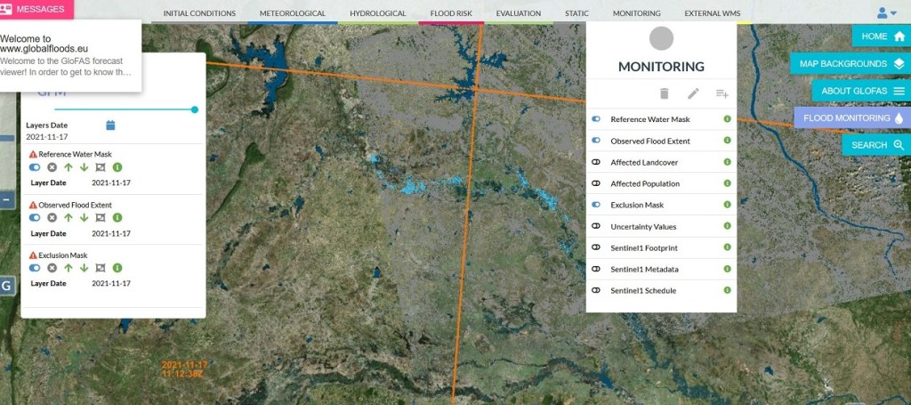
Launched by the Joint Research Centre, the European Commission’s science and knowledge service, the Global Flood Monitoring tool is designed to monitor ongoing floods around the world. A team of researchers from the Luxembourg Institute of Science and Technology (LIST) developed one of the three algorithms for extracting satellite data.
Improving both the emergency response and the prevention for future floods worldwide
Making the most of the synthetic aperture radar of Sentinel-1 that enables image acquisitions regardless of weather or daylight conditions, the Global Flood Monitoring tool will improve both the emergency response and the prevention for future floods worldwide.
The Global Flood Monitoring tool allows users to better prepare for an upcoming flood and to better react to an ongoing flood. This systematic, global, high-resolution monitoring represents a significant advance in EU disaster awareness and prevention.
This revolutionary tool produces flood monitoring maps in less than 8 hours after the satellite has acquired the image. For Europe, the tool can provide flood monitoring maps updated every 1-3 days. For areas outside Europe, the update of flood maps can take between 6-12 days depending on the Sentinel-1 schedule.

The tool is available free of charge to the civil protection services of the EU Member States and its partners.
The Global Flood Monitoring tool is part of the Copernicus emergency management service. Copernicus is an EU programme aimed at developing European information services based on satellite Earth Observation and in situ (non space) data.
A seasoned Luxembourg research team
LIST researchers Patrick Matgen, Ramona Pelich, Marco Chini, Renaud Hostache, and Yu Li developed one of the three algorithms for extracting satellite data.
“We have been working on flood monitoring technologies for 15 years. We are grateful to the National Research Fund and the European Space Agency for having funded this research for so many years […] We are proud that our algorithm is now a central component of the operational GFM service.”
Patrick Matgen, Group Leader at LIST
The research team has already generated many flood maps using satellite data using the HASARD® tool.

More about the Luxembourg Remote Sensing and Natural Resources Modelling research group.


